Thursday, September 28, 2006

Day 3: Commando Camping

Sorry I haven't posted in a while. I hope you haven't given up on me; I worked everyday this week. I can always count on work to suck all the creativity from my soul. Also, I started on this post a few days ago and it got lost. For some reason, I absolutely cannot stand to do something twice. So, it has taken every drop of self discipline that I posses (about two drops) to sit in front of the computer and try to muster any details at all from my memory and write something that isn't an abomination. Good luck, kind reader:
Here we are at Cartersville, the deceivingly small town. My map had this block of houses labeled in bold letters, making me think it was an actual town. You know, with a store, where I could get a nice cup of coffee, a Dr. Pepper, and a new bag of M&Ms. Water crept into the bag from the day before. James River flavored M&Ms are not very good. Luckily though, there was a trash can at the ramp so we were able to get rid of some weight. But, there was no restroom. That would have to wait.

What can I say about Cartersville, other than "disappointing"? Quaint. Quiet. I can't help but to wonder where in the hell these people work. The houses in Cartersville were quite old, but maintained in very good condition. It's one of those places visitors say, "Man, I'd love to live here," and the locals say, "I'm sick of this one horse shithole."

To be fair, Cartersville was very quiet and charming. The houses were all quite old and probably nested well-off people that enjoy quiet, country living and taking care of the old structures. Just don't plan on using it as a restocking point if you are on the river. We obviously didn't see this place during our brief visit. For that matter, we only saw two people: A retired man splashing his fishing boat who didn't know where Cartersville was, and a woman who tried to run over us with her car.

The man with the boat immediately reminded me of my grandfather. Before hitting the beach, I noticed his well kept beard and white hair. He didn't let the image of my grandfather down as we reached the beach and he started into a conversation as if he had known us for years. Apparently, he loved to fish. When he found out we had come from Charlottesville, he went into a story about his trip down the James some years back. He didn't go as many miles as we did, but it still took four days for his journey to conclude. His boat drifted most of the way as he fished the banks of the James River. At night, he camped on islands, eating the fish he caught during the day.

As he told his story, his eyes wondered far off, not really looking at anything. It was apparent he was reminiscing, and he loved to fish. He made a couple of funnies, giving us a pretty good laugh. During the few moments we were in his company, I was a little kid again, hanging out with my grandfather-the man who can make anybody laugh, build anything, and do no wrong.

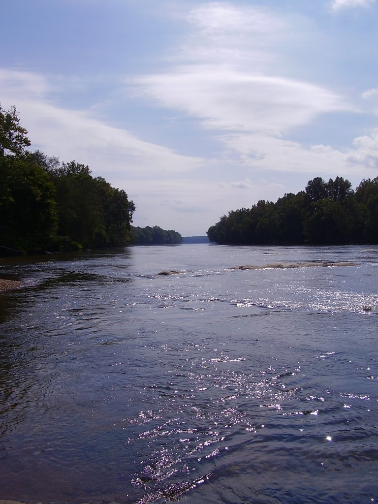
The rest of this story is coming directly from memory, which is about as good as pulling it directly from my ass. If any of it is wrong, I will update it. The way I see it, this is my story and I can tell it however I want.

Day 3 turned out to be the most beautiful of the whole trip. After leaving Cartersville, we paddled along the expansive James River, again sometimes being so far from each other we didn't talk for a few hours at a time. B.I.L. paddled the banks, again, trying to find treasure. I on the other hand, don't enjoy the threat of dead trees falling on me, so I stayed near the middle and enjoyed the easier paddling of the faster water there.

Everybody thinks I'm kidding when I mention dead trees falling into the water. During a day trip on the Rivanna River last Spring, I witnessed a hawk landing on the top of a dead tree trunk. As he touched down on the jagged stump, about 30 feet in the air, the dead trunk gave in and fell to the water with a tremendous splash. An almost identical situation happened about 25 yards behind B.I.L. on this day. There was no bird, but a large limb fell from the top of a tree and crashed into the water, directly where B.I.L. had been paddling a few moments before. Told ya.

I think MapQuest is on to me. Shhh. I can't save the map anymore and write on it to show you what we did. When I right click on the map, it zooms now. It used to let me save it. Damn, you mean I have to come up with my own maps? I can't just pira...borrow them from MapQuest, anymore? What's the deal?

I can't remember how many miles we paddled for this day. I'm sure B.I.L. will let me know, and I will add that later on. We did at least 30 miles. There was a little blotch on the map marked, "Public Use Area". Hoping for a campground, we paddled like mad to get there. There is a clearly defined island on the map called Sabot Island. I was using Sabot Island as my landmark to locate the "Public Use Area," but there is a difference between maps and the real world. The little river that hooks into the James to form Sabot Island, called Little River, is really little. I never saw the little bastard, and therefore could not tell the difference in Sabot Island and the regular bank. This bit of il-navigating ultimately led us to a pretty cool camp site. You'll see what I mean, later.

Another difference between real life and maps are the symbols used to mark riffles and rapids. It is the same symbol. The little riffles in the Rivanna River are marked with the same symbol as the class V rapids in downtown Richmond. This means you cannot tell from reading a map if that water you hear up ahead is a riffle, a class V rapid, or a waterfall. An area that we took a particular interest in was a squiggly line (riffle, rapid symbol) running across the blue part of the map that denoted the James River, near a group of islands. Islands and squiggly lines on maps are a good recipe for rapids. I held the map in my lap and navigated our way, very well, through the group of islands. The squiggly lines turned out to be small riffles that we named "No Problem". This part of the James River was extraordinary. Islands broke the river apart and turned it into large streams, some smaller than the Rivanna River. The James bubbled over rocks and through islands, resembling a mountain brook. It really reminded me of places I visited with my mom and grandparents as a kid in Montana. Traversing this area made me think very hard about a paddling trip in Montana. The Montana trip idea was killed this night while I was trying to sleep.

The sun was going down and the shadows from the banks were getting longer until they finally traversed the width of the river. By this point, we had left the islands, I had missed the upstream point of Sabot Island, and we were coming up on a small group of little islands that were not on the map. Although a river only runs one direction, I was lost. I had no idea where we were in relation to Sabot Island and the islands we were now entering were not on the map. My navigation skills had been promising to this point. But at the moment, I couldn't figure out where we were. I hollered at B.I.L. to pull into a beach if he found one because I needed to pee. Actually, I needed a guise because it was getting dark and I had no idea if we had passed the "For Public Use" place or not.

B.I.L. found a great sandy beach on the first island of the group. I landed my boat and began studying the now useless chart. "Did you see the tip of Sabot Island, yet?" I asked B.I.L. acting like anybody could miss it if I did. To my relief and disappointment at the same time, B.I.L. had not seen it, either. We stayed on the beach for a little bit as I peered at the chart. B.I.L. followed a sandy path behind some trees and found the Eden of campsites. The other islands had "No Trespassing" signs posted all over them, but this one was not marked. B.I.L. took this photo the next morning. Notice you cannot tell we camped there. This was a priority for us on all of our campsites. I wish more people could camp this way.
B.I.L. was awesome about the whole ordeal, so we decided to make camp on this spot. We named this one "Probably Private Property, But Who Cares, I'm Tired." In about half an hour, we had our boats hidden on the sandy path, the tent was pitched, and B.I.L. was starting the stove. As normal, I was running my mouth when B.I.L. shhh'ed me. I could tell by the look on his face I needed to shut the hell up, so I did. Then I heard it, too. Voices. We immediately dropped to the sand, hoping to not get caught. This just turned into a situation of Commando Camping, a term coined by B.I.L. Some dork in a Hobie Kayak was paddling upstream without a PFD or shirt, even though it was getting rather cool at this point. He rode the small rapids next to our campsite back down towards a friend in a canoe, who was waiting downstream. He never saw us, and we didn't see anybody else the rest of the night.

The photo above shows the kayaks hidden on the sandy trail. The campsite is to the left. Can you guess which shadow belongs to which person?

I tried to stay up until nine that night so that I could call the blog from B.I.L.s cell phone, which remarkably had coverage. At about 8:30, I was dead to the word, curled up in my sleeping bag prepared for the coldest night during C.R.A.K. This is what killed the Montana expedition idea. Knowing we would be reaching Richmond the next day, we agreed to get up early and leave as soon as there was enough light on the water. We also had a time frame of only a few hours in which my wife's wonderful sister could pick us up once we reached Richmond. Will we make it? Stay tuned...


Fair winds and following seas...

Sunday, September 24, 2006

Day 2: How to Drink Coffee From a Sports Bottle.

We woke up a few hours after the butt crack of dawn to break down the camp and prepare our boats for our first long day. Day 2 found us leaving the Rivanna and entering the cavernous James River. About three miles from our camp we stopped in Palmyra to answer the call of nature at a conveniently located store where I scored a large bag of M&Ms and a cold Dr. Pepper. This stop would turn out to be the first, and only, time I would take a crap on the trip. That could have been a good thing, considering I did not have to tote a bucket of poop with me, but it ultimately led to problems for me on the last day. But I digress.

As I said in the Day 1 post, we searched for the other camp site that is marked on the map, but were unable to locate any such place in real life. We didn't need it, so it wasn't a problem. I'm adding this tid-bit in case someone else would rather pass the first spot and camp further down stream. Good luck finding it.

A new bridge is under construction in Palmyra. The construction crew seemed to be pleasantly entertained as we dropped off a small ledge in their work zone and headed down the peaceful Rivanna River. Reportedly, the new bridge will host a pedestrian and bike path to allow more convenient access into Palmyra. Sounds pretty good, we'll see how it turns out.

When we left the camp area this morning, a bunch of suds caught up to us that we passed the day before. The suds began to show up in the vicinity of Lake Monticello, then fizzled out later on during day 1. On the morning of day 2, I caught sight of some globs of foam that have been in the news recently along the James River. Before now, though, the foam has not been mentioned in the Rivanna River. Because of lighting, we were not able to get any decent photos of the foam. I will probably return to the area in a week or so to take some pictures and grab a couple of samples. Nobody is very sure about the source of the foam, or even what chemical properties are causing the phenomenon. It's still pollution, and I don't like pollution in my river. The foaming idiot causing this mess will be found and hopefully the river will not be too badly damaged.

On a better note, we did see our first bald eagle of the trip while on the Rivanna River! Unfortunately, we did not get any pictures. We also saw a couple of Osprey soaring above the trees, numerous ducks, tons of geese, a few kingfishers, heron, woodpeckers, and an unidentified mammal swimming in the water. Most likely, he was a groundhog since there were no signs of beaver in the area. The Rivanna River does play host to mink, though, so it is possible we saw the ever elusive and shy mink.

I thought I was eager to get out of the Rivanna and begin exploring the new territory of the James River. I thought this, until we finally reached the James. When we entered the huge, expansive James, I looked back at the dwarfed Rivanna and began to feel out of place. Part of me wanted to paddle back into the narrow break in the trees that marked the mouth of the Rivanna. An overwhelming sadness cloaked my body as I watched it fall away farther and farther off my stern. It looked like a creek compared to the wide bodied, slow flowing James. I had the misfortune of the slow moving James keeping the Rivanna within my eyesight for quite a while. Finally, I had to force myself to look ahead and leave my river behind. There was a whole world of opportunity ahead of me, even if I didn't know about it at that time. To keep myself from becoming home sick, I concentrated on the task at hand and aimed my bow in the direction of Elk Island.
Other than the guy challenging me from the bank on the Rivanna, the James brought to us our first encounter with other people enjoying the river. A couple of people were fishing from a small boat in the James at the mouth of the Rivanna. There is a state boat ramp across the river from Columbia, a small, near ghost town that sits at the intersection of the Rivanna and the James.

In its day, Columbia was a bustling city having the advantage of prime real estate at the intersection of the two busiest shipping lanes in that area of the state. Small wooden boats called Batteau carried goods to and from Charlottesville on this route. A system of locks, canals, and dams were built to accommodate the boats. In some areas of the Rivanna the ruins are still visible, including an aqueduct that actually crossed the river at one point.

We paddled for several hours, covering about 30 miles during the day. Eventually, Elk Island appeared on the horizon and we paddled towards it for a couple of hours before actually reaching the upstream beach and stopping for lunch. I took the opportunity to check the charts and figure out where we might want to stop for the night. The
downstream end of Elk Island looked to be about all the paddling we would be able to handle.

Elk Island is rather large, so we paddled along side of it for most of the afternoon. It was covered with farmland that appeared to be raising corn in its fertile soil. An unfortunate observation I made anytime we passed farm land, whether it be crops or cattle, was an over abundance of plant growth in the river. This is the effect of fertilizer pollution in the river. This type of pollution is a great example of how rivers become tainted. Unlike the common types of pollution, such as storm water drainage, water treatment plant drainage, and trash, like tires and forty ounce beer bottles, fertilizer is not dumped directly into the river. Instead, it is carried to the water by runoff. When we do things like cultivate the land, or build paved driveways, rain water cannot be absorbed by the soil and quickly makes its way to the rivers. With it goes everything we have put in the soil-fertilizer, pesticide, herbicide, any kind of chemical that is not naturally found in that area.

When fertilizer gets into a river or stream, it does what it is designed to do and encourages foliage to grow. "Why is that so bad?" You may be asking right now. "Wouldn't that be good for the animals that eat the plants?"

The answer to this question is "No!" River animals that eat plants are normally scrapers. That is, they scrape the plant material from the rocks and other hard surfaces that plants grow on. The scraping action of these organisms keeps plant growth within reasonable limits, allowing the bug to gain the purchase it needs to hang onto the rock and eat. Remember, rivers are always flowing and a bug that can't hold onto something, gets washed away. When fertilizers cause the plants to grow at a rate faster than the organisms can eat them, the organisms get washed away because they can no longer hang on to anything, thus, they die. The lack of plant eating bugs in an ecosystem allows the plants to grow even more out of control, and chaos ensues.

The same goes for pesticides and herbicides, only with a more noticeable impact. Pesticides, of course, kill all the organisms in the stream, including fish. While herbicides kill the plants and start the same process that fertilizers do. No plants, no plant eating bugs. Then the organisms that eat the plant eating bugs disappear, and so on. That is how the food chain works.

Because of this type of pollution in addition to viruses and bacteria, we were afraid to use any water purifying gadgets in the river. We packed all of the water we would use and carried it with us the duration of the trip. The boats were a little heavy, but neither of us got the runs.

I grew up in a farming community and have even done some farming myself. I love the lifestyle and would like to be able to have a farm of my own sometime. Traditional farming is very destructive, especially near a body of water. That is why farmers need more incentive to switch to organic farming. Using fertilizer and pesticide on genetically modified crops is an easy, inexpensive way to yield high production, even if it depletes the health of the consumer.

It never fails; anytime I go kayaking, I get rained on. This trip was not to be the exception. Thunderstorms had been forecast for this day for about a week. We got hit hard for about twenty minutes with barrels of rain. Soaked and tired, we finally reached the end of Elk Island and discovered a nice camping spot on a small hill at the narrow tip of the island. Raccoon tracks littered the area, so after cooking dinner, we strung up some lines and hung all of our gear out of the reach of the crafty critters.

The camp site was ideal. Nice, soft dirt under the tent. Even a slight trickle could be heard from the river crossing a rock just off the bank. It was perfect until the sun went down and the first train went by. Every twenty minutes, all night long, a train passed by. There were no crossings within twenty miles, so we didn't have to put up with horns, but the rumbling engines and clacking cars kept us up most of the night. At about six A.M., I had enough and crawled out of the tent. B.I.L., not able to sleep as well, followed me outside where we made our breakfast and some instant coffee. We sat there waiting for the sun to give us enough light to pack the boats and get going again. At about 8 A.M. we were back on the water and paddling towards Cartersville, where we thought we would get some good coffee and maybe more M&Ms.

How to Drink Coffee From a Sports Bottle: First you need the nastiest tasting instant coffee you can find. Add just one (and please, for the love of God, not any more) teaspoon of the powder to an empty sports bottle (the kind bicycle riders drink from). Heat some water over your camp stove, don't worry about bringing it all the way to a boil. Boiling water will melt the plastic water bottle, anyway. Add the water to the bottle, snap on the cap and shake vigorously. Drink at your own risk. On the last day of the trip, your paddling partner will tell you he has sugar so you can add that to your last cup to make it actually potable.


Fair winds and following seas...

Saturday, September 23, 2006

Day 1: Getting Underway

Sept. 18, 2006: Our starting point was Woolen Mills dam in Charlotte- sville. As mentioned in an earlier post, we had no car to get our kayaks to this point. Luckily, this area is only a couple of blocks from my house, so we were able to carry the boats to the launch site. B.I.L. had a nifty set of wheels that strapped to his boat. We made a little kayak train down the road with one of us at the bow of my boat, the other carrying the stern with one hand and dragging the larger yellow boat on its wheels. When the person acting as the coupling between the two kayaks became too exhausted to hold the boats, we would switch positions. Most of the injuries for the entire trip occurred during this carrying phase. It really sucked big nuts.

At one point on our way to the river, a young Hispanic couple stopped and asked me for directions. But, they didn't "ask". Instead, they handed me a map that had a star marking their intended destination. I asked if they spoke English, to which the woman replied, "poquito"(sp?). "Shit" was my reply. Then B.I.L., who like I have said earlier, always comes through in any situation, came over and started speaking nearly fluent Spanish to the people! I forgot he used to live in South America and together, we got them turned in the right direction. While we were talking to them, some guy came out of his house and said, "You guys lost?" Then he looked at the two heavily loaded kayaks laying on the ground and said, "The rivers that way" and pointed in the same direction the kayaks were facing. No shit? Gee Willikers, thanks Mister!

Here are some pictures that help explain why it sucked so bad to carry the boats by hand to the river. On the bow of my boat, seen in this picture, is a dry bag with all the food I will have for the trip (minus a bag of M&Ms and a Dr. Pepper that I will acquire later on). Inside the bow, between my knees, sit three gallons of water. The stern storage area is covered by my PFD in the picture, but that is where my sleeping bag rode, along with a pair of flip-flops and assorted odds and ends that I tossed in there along the way. The next photo details the cockpit area.


One of the three gallons of water is visible in this picture. The red thing behind the seat is my backpack with the rainfly pulled over it. The backpack carried dry clothes, a rain coat, one fleece pull-over, duct tape (an essential item), extra batteries, a compass that I completely forgot about until the last day, a cigarette lighter, and all the charts that we would cover(a total of 8 charts were covered on this trip). This backpack has been with me since I lived in Juneau, AK. I have taken it on all of my hiking and mt. biking trips, and it has served as my carry-on when flying. Now it has ridden with me in the kayak. Tucked behind the seat with the backpack is a diving flashlight(extremely bright and water proof), sun block, and something else that I can't recall at the moment. To the left of the seat is a diving knife and my sleeping pad(rolled up blue thing). On the right is my GPS (Thanks, Mom!) and a bag filled with snack food because I eat a lot. The black pole on the right of the seat is my paddle and I have no idea what the blue thing is behind the cockpit.

Here is B.I.L.s boat, the workhorse of C.R.A.K. He is carrying everything I am, plus more water, the tent, stove, even the wheels that we rolled it to the river on! The kayak was very nearly loaded to its limit. With B.I.L. sitting in it, the boat only had about two inches of freeboard! But it lost weight everyday as we drank more water and ate more food.

I got home from work at about 7:45 Monday morning. By the time we loaded our boats and carried them the distance to the river, it was 11:30ish before we finally departed. The Rivanna River was flowing very well. Even with the yellow boat as heavy as it was, we never had to get out and carry the boats. Only in one area did we get out to scout a route through some rocks.

We had a nice route picked out to river right that looked shallow, but the flow was an even, straight line. River left hosted a wild looking spill over some rocks that took an abrupt left turn through a small rock garden. It was definitely passable, but not what we were looking for with the amount of weight we were carrying on our boats. B.I.L. went first down the right side without any hitches. I began to follow when I heard a voice hollering, "Red boat!" I looked around and saw an older gentleman standing on the left bank. Puzzled, I paddled closer to him to see what he wanted to say. We hadn't seen anybody, not even other boaters, all day. Now out of nowhere, an old man shows up and starts telling me to take the route on the left. I was shaking my head "no" and pointing to the right when he challenged me with, "I did it the other day in my canoe." Oh, it's on, old man!

I steered my boat to the spill and paddled off it, bouncing off the rocks at the end. No harm done, I looked back and waved with a smile to the man on the bank. When I looked back in front of me, that's when I noticed the next drop that couldn't be seen from our scouting area up stream. My kayak fell off the drop in perfect form, bow first. I paddled like mad to keep from tipping as the standing wave at the bottom of the short drop gushed into the cockpit and gave me a good soaking from my neck to my toes.

B.I.L. was already at the bottom laughing at me as I spilled down the rocks into the more calm water where he was waiting. "What the hell are you doing?" was his greeting. "That old man on the bank said he did it the other day in his canoe; I had to do it. I think he's full of shit, though," I said, sponging the water out of my boat.

The rest of the day was fairly calm. There were a few areas on the map that we were a little nervous about. Some dams were marked that we had never seen before, but they had all been breached long ago and posed no threat to us.

At about 16 miles from our put in, two public camping areas were marked on the map. The first one was on an island and the second was on the right bank, past the island after a large "S" bend in the river. We stopped at the island, which had obviously been camped on, and stayed the night, although it wasn't marked as a campsite. The next day we looked for the camping area on the right bank and never found it. Neither of the public camping areas on the Rivanna River are marked. That made a couple of tired kayakers pretty pissed on their first day, but all worked out fine in the end.


Fair winds and following seas...

Thursday, September 21, 2006

Done!!

We made it to Richmond a couple of hours ago. The GPS is showing 89.8 miles, but the batteries began dying at the end of the trip and it shut down a couple of times. Actual mileage is closer to 95. The Rivanna was gorgeous and treated us fairly well. There were a few spots of small rapids called riffles, but they didn't give us too much trouble. Day 2 put us on the James. The first part of the James was extremely boring. It was wide and the current was slow, so it felt like we weren't moving. For all the effort it takes to paddle a loaded kayak, it was a little disheartening. Day 3 was filled with excursions through scenic islands where the river split into several smaller bubbling brooks. Day 4 (today) started out foggy on the water and cool enough to warrant B.I.L. and I to sport our fleeces. By noon we shucked the long sleeves and enjoyed another boring paddle in the wide, slow moving James River. We had to portage around 2 dams as we migrated into the last map of the trip. The day of boring and slow paddling ended with cockpit filling class III and IV rapids.

The trip went extremely well-by that I mean we are both alive and neither of us took a spill, quite a feat for nearly 100 miles in a kayak. We took a few pictures, but not as many as I had hoped. Turns out, it is unbelievably hard to hold a camera, read a map, and paddle a kayak, all at the same time. After I get some rest and a very large dinner and breakfast, I will post the day-by-day events and explain why I didn't blog during the trip. More to come over the weekend.


Fair winds and following seas...

Monday, September 18, 2006

T Minus 6 Hours...

I am at work right now. It is 3:17 am according to the computer I am on. In 4 hours and 13 minutes I get off work and will ride my Vespa home, where B.I.L. is comfortably asleep at the moment, and we will somehow get the yaks down to the river and begin the most anticipated event of the season.

C.R.A.K. is getting off to a rough start, thus far. With all the planning, charting, checking and rechecking of gear, practice and scouting trips, we forgot one minor detail. We don't have a car. My wife has to be at work at 7:00 am; taking our only car. When 4 hours and 13 minutes is added to 3:17, the sum is 7:30. B.I.L.s wife had to go back to Richmond yesterday because she, too, has to be at work this morning. Uh-oh.

Never to fear! B.I.L. is here! B.I.L. is one of those people you can always count on to pull through in any situation. That is why I am so pleased he is going on this trip. At the last moment, he whipped out a nifty set of wheels that strap onto the kayak so it can be pulled around, rather than carried. We may have to do this in two trips, but we are going to be able to wheel the kayaks down to the river-no car needed! Our put in is only a couple of blocks from my house, farther than we want to carry the yaks, but close enough to wheel them down there with his contraption.

As I was getting ready for work, B.I.L. made the last run for food, water and hopefully, beer. On my way out the door I bid my wife goodbye and goodnight, being as I won't see her again until our return. Everything is set. B.I.L. has his camera packed (mine is still lost), and all the gear we need including food, water and shelter. What a swell guy that B.I.L. is.

Just as predicted, I didn't get much sleep yesterday, so the first day should be a pretty good grump fest on my part. We hope to make it to the James in one day, we'll see how I fare throughout the first leg of our journey. A public campground is conveniently located at the halfway point of the Rivanna to the James. We intend on going all the way to the James today, but we do have the option of stopping short at this campground if I can't hack it.

I will be keeping a daily log and calling home when we have cell service so my wife can update the blog. B.I.L. might include his two cents as well, so that should add an interesting two person perspective on the daily events. Check in every evening or morning for updates. Also, keep an eye out for sound bites from the field. I have set up a system on the blog that will allow me to call and leave voice mail type messages for you to listen to. That should work out really well with my non-Ted Coppell voice. It'll probably sound more like Don Gay or Willie Shoemaker. No offense to either of these extraordinary gentlemen, they just happen to be short Texans, such as myself, with no voice for commentary.

Weather: Weather.com is predicting partly sunny skies all week with the exception of Tuesday, when thunderstorms are expected. Highs today will be 89! Dropping to the mid 70s for the rest of the week. Looks like the nights will be a little brisk, dipping into the low 50s and 48 on Wednesday. That'll be nice after a day of rain...

Rain is ok, but lightning is a show stopper. If the rain becomes torrential or lightning strikes, we will have to stop and set up camp. That weather is just too dangerous to be on the water. We'd like to survive this trip, if at all possible.

River Conditions: The Rivanna River, leg one, is at 2.85 ft. That is pretty good, we should be able to paddle the length of the Rivanna without bottoming out and having to walk. The Cartersville gage on the James river, leg 2, has dropped drastically over the weekend. This morning, it is standing at 2.04 ft, which is fairly low for that area of the river. The James River at Richmond Westham is at 4.61 ft this morning. Again, another area with good flow. We should be able to make up for any lost time with that amount of water under us. And finally, the last gage on our route, which is in an area of locks known as Richmond Locks, is reading 2.21 ft right now. This gage is constantly changing as the locks empty and fill, so it is a good estimate of the river through this area, not a reading of actual conditions.

With the exception of predicted thunderstorms for Tuesday, the weather and river look promising for the coming week. The low water at Cartersville should fill up from Tuesday's showers before we get there, so that should not pose a problem. Now the only threats we face are snakes in sleeping bags (my worst fear), and getting shot at for camping in the wrong spot. All in all, it should be a good trip!


Fair winds and following seas...

Saturday, September 16, 2006

2 Days To Go!

News from the C.R.A.K. Still no freakin camera and no money to buy one. Hopefully BIL's not-so-reliable camera will decide to behave itself and take at least two pictures during the trip. Then again, he still hasn't emailed me the pictures he took three weeks ago*. It rained last night, but on the way home this morning the sun was out. It was a beautiful morning for a ride on the Vespa. I passed three people walking and one person riding a bike and got a smile from each of them. The biker even waved as I passed. At first, I thought it was because I looked so good, but then I remembered I was wearing a full faced helmet. So I have to give credit to the "cute" scooter. The wave and smiles really made up for the asshole in the S.U.V. riding my ass for most of the commute. I was doing the speed limit...P.S. I can call people in S.U.V.s assholes because I don't have one anymore. An S.U.V. I mean. I still have an asshole, and like those S.U.V. drivers, it stinks.

After a wonderful morning of scootering, I logged on to check my email and stumbled across this story on AOL. Had I been the one writing it, I would have called it "White Flight Hits All Time Low". I have a feeling some of the people that read this blog won't agree when I say so, but this is really sick:

Here is the link so you can read it as published on AOL with pictures.


Immigration Raid Makes a Ghost Town
By RUSS BYNUM, AP

STILLMORE, Ga. (Sept. 15) - Trailer parks lie abandoned. The poultry plant is scrambling to replace more than half its workforce. Business has dried up at stores where Mexican laborers once lined up to buy food, beer and cigarettes just weeks ago.

This Georgia community of about 1,000 people has become little more than a ghost town since Sept. 1, when federal agents began rounding up illegal immigrants.

The sweep has had the unintended effect of underscoring just how vital the illegal immigrants were to the local economy.

More than 120 illegal immigrants have been loaded onto buses bound for immigration courts in Atlanta, 189 miles away. Hundreds more fled Emanuel County. Residents say many scattered into the woods, camping out for days. They worry some are still hiding without food.

At least one child, born a U.S. citizen, was left behind by his Mexican parents: 2-year-old Victor Perez-Lopez. The toddler's mother, Rosa Lopez, left her son with Julie Rodas when the raids began and fled the state. The boy's father was deported to Mexico.

"When his momma brought this baby here and left him, tears rolled down her face and mine too," Rodas said. "She said, `Julie, will you please take care of my son because I have no money, no way of paying rent?"'

For five years, Rodas has made a living watching the children of workers at the Crider Inc. poultry plant, where the vast majority of employees were Mexican immigrants. She learned Spanish, and considered many immigrants among her closest friends. She threw parties for their children's birthdays and baptisms.

The only child in Rodas' care now, besides her own son, is Victor. Her customers have disappeared.

Federal agents also swarmed into a trailer park operated by David Robinson. Illegal immigrants were handcuffed and taken away. Almost none have returned. Robinson bought an American flag and posted it by the pond out front - upside down, in protest.

"These people might not have American rights, but they've damn sure got human rights," Robinson said. "There ain't no reason to treat them like animals."

The raids came during a fall election season in which immigration is a top issue.

Last month, the federal government reported that Georgia had the fastest-growing illegal immigrant population in the country. The number more than doubled from an estimated 220,000 in 2000 to 470,000 last year. This year, state lawmakers passed some of the nation's toughest measures targeting illegal immigrants, and Republican Gov. Sonny Perdue last week vowed a statewide crackdown on document fraud.

Other than the Crider plant, there isn't much in Stillmore. Four small stores, a coin laundry and a Baptist church share downtown with City Hall, the fire department and a post office. "We're poor but proud," Mayor Marilyn Slater said, as if that is the town motto.

The 2000 Census put Stillmore's population at 730, but Slater said uncounted immigrants probably made it more than 1,000. Not anymore, with so many homes abandoned and the streets practically empty.

"This reminds me of what I read about Nazi Germany, the Gestapo coming in and yanking people up," Slater said.

Immigration and Customs Enforcement spokesman Marc Raimondi would not discuss details of the raids. "We can't lose sight of the fact that these people were here illegally," Raimondi said.

At Sucursal Salina No. 2, a store stocked with Mexican fruit sodas and snacks, cashier Alberto Gonzalez said Wednesday that the owner may shutter the place. By midday, Gonzalez has had only six customers. Normally, he would see 100.

The B&S convenience store, owned by Keith and Regan Slater, the mayor's son and grandson, has lost about 80 percent of its business.

"These people come over here to make a better way of life, not to blow us up," complained Keith Slater, who keeps a portrait of Ronald Reagan on the wall. "I'm a die-hard Republican, but I think we missed the boat with this one."

Since the mid-1990s, Stillmore has grown dependent on the paychecks of Mexican workers who originally came for seasonal farm labor, picking the area's famous Vidalia onions. Many then took year-round jobs at the Crider plant, with a workforce of about 900.

Crider President David Purtle said the agents began inspecting the company's employment records in May. They found 700 suspected illegal immigrants, and supervisors handed out letters over the summer ordering them to prove they came to the U.S. legally or be fired. Only about 100 kept their jobs.

The arrests started at the plant Sept. 1. Over the Labor Day weekend, agents with guns and bulletproof vests converged on workers' homes after getting the addresses from Crider's files.

Antonio Lopez, who came here two years ago from Chiapas, Mexico, and worked at the Crider plant, said agents kicked in his front door. Lopez, 32, and his 15-year-old son were handcuffed and taken by bus to Atlanta with 30 others. Because of the boy, Lopez said, both were allowed to return. In his back pocket, he carries an order to return to Atlanta for a court hearing Feb. 2.

But now, "there's no people here and I don't have any work," he said.

The poultry plant has limped along with half its normal workforce. Crider increased its starting wages by $1 an hour to help recruit new workers.

Stacie Bell, 23, started work canning chicken at Crider a week ago. She said the pay, $7.75 an hour, led her to leave her $5.60-an-hour job as a Wal-Mart cashier in nearby Statesboro. Still, Bell said she felt bad about the raids.

"If they knew eventually that they were going to have to do that, they should have never let them come over here," she said.

*BIL, I'm just busting your balls, dude. Take your time with those pictures.


Fair winds and following seas, illegal immigrants...

Wednesday, September 13, 2006

Edge of Your Seat Suspense...

So this is what has been up lately. I went to Richmond last Saturday to get some more time on the James River with B.I.L. The kayak never left its perch on the roof of the car. We both decided we were too tired for all that business, and we have seen it before. So we took a walk along the river and watched some rafters and a couple of kayaks take on the flooded conditions around Belle Isle. From an observation point at Washington cemetery, where we saw an ex-presidents final resting place, we watched the torrential James as millions of gallons of water poured over the rocks. We looked for lines that seemed safe enough for us to follow with our kayaks loaded down with four days of trash and doo-doo only to have those plans change once again when we stood on the banks and watched 4 to 6 foot standing waves alter the routes. Eventually, we did decide on a safe route where the water wasn't flirting with class 5 action. Hopefully, we will be ok. The recent rains have really swelled the river like an anaphylactic bee sting.

We took some leisure time to drink beer and finish the chart work. Assuming the beer did not hinder my charting skills, we figure it will be almost 90 miles from Charlottesville to Richmond. After a passive look at each other with a brief pause and a couple chugs of beer, we said, "Let's do it".

Our plan right now is to leave on Monday morning of the 18th after I get off work. Keep in mind I work 12 hour night shifts. I also work Saturday night, and Friday night. I'm hardy though. We can do this. B.I.L. has all the gear we need. He even scored a sleeping bag and a mat for me! A couple more dry bags and some food and water and we should be set to go. Oh, except I lost my camera! Still haven't found that pesky thing. I am starting to wonder if Jeepyak has it at its new home...

The river levels are holding steady and are only up a few feet. Perfect conditions for a trip like this. The faster water will mean more miles covered in a day of paddling. We need to cover lots of miles every day in order to do this before my anniversary on the 21st. Also, the hurricanes, that's right, hurricanes, don't seem to be a threat to C.R.A.K. Weather.com is predicting sunny, warm days and clear, cool nights during the trip. Good camping weather.

We now have the plot, and the antagonists are being introduced. I don't have a camera. We are leaving after a long weekend of work and no sleep for me, and my anniversary is the deadline, only three days from the day we leave. And we think it will take four days to complete. Ooooo, I love a good story with loads of suspense. Will Riveryak be able to make the required mileage the first day? Will his camera be found before they leave? Will he make it home before his anniversary so he doesn't end up divorced? Will Riveryak crash his kayak on the last day and be covered in his own buckets of doo-doo? Stay tuned for these and other exciting adventures with Riveryak and B.I.L.!

Friday, September 08, 2006

I Thought JeepYak Was Good!

Hello everybody and welcome back to Riveryak, my favorite place on the internet. I always thought I would never find a replacement for hauling kayaks once JeepYak was gone. The flexibility of the soft top molded perfectly to every hull ever strapped to it, virtually eliminating the need for lateral tie downs or a rack. And the windshield tie down loop on the hood made a perfect anchor for bow straps. This method was tried and true and never failed me. I thought it was the perfect way to haul kayaks, until I got this:


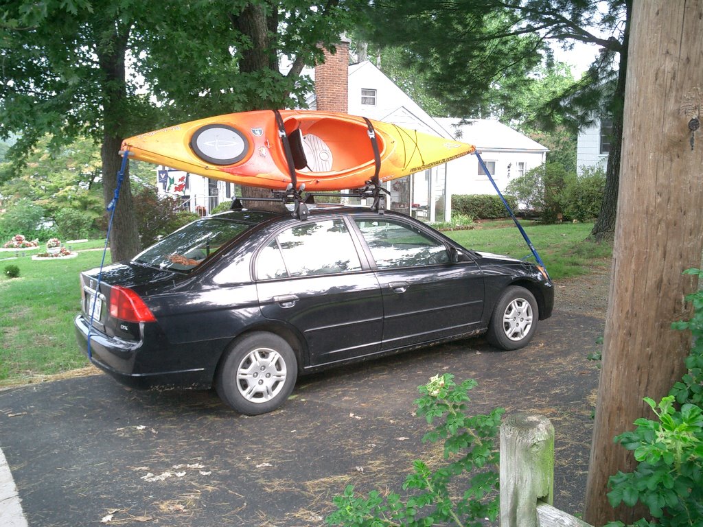
Holy crap can this thing haul a yak! That is a Yakima roof rack with Yakima's Hull Raiser kayak carrying system. Here is a better view of the J-hook design Hull Raiser:


The straps on the bow and stern are really not necessary. When the J-hooks' straps are cinched down, they hold the kayak like Hulk Hogan holding an opponent in the Rolling Crucifix Armbar. Without the bow and stern tied down, I shook the kayak hard and it moved the whole car! Yakima recommends securing the bow and stern, so I do.

I'll leave you today with a couple of more pictures of the kayak secured to the car. I took closer pictures of the J-hooks, but they didn't turn out. My camera is in here somewhere, but I don't know where. I borrowed my brother in laws camera to take these photos. It's one of those tiny creations that is designed to fit in your pocket. It's also the right size for my fingers to be in the lens if I hold it like a normal sized camera.


Fair winds and following seas!

Tuesday, September 05, 2006

OK, God, Enough is Enough

It has been raining since Friday. The Charlottesville area is reporting .9" in the last 24 hours. I haven't seen a definite figure for the amount of precipitation for the last 120 hours, but I'm guessing we have had about 3". The Rivanna flood gage is reading 6.24' right now and climbing with a rise of over 3' just yesterday! The predicted rise is to 10.5' before tomorrow. Uh-oh. The river doesn't reach "action stage" until 15', but a prediction of 10.5' leaves a narrow margin for error. And there is more rain to come.

The James River seems to be taking this rain in strides and doesn't really care that it's raining. A flood gage in Cartersville is reading 3.51' with a predicted rise to 6.8'. Not a big deal since that area reaches action stage at 16' and doesn't flood until 20'. But still, a little too much water for a couple of amateur kayakers loaded down with camping gear.

Further downstream and closer to Richmond, the James is showing 5.46'. That is down from 8.6' on Sunday with a prediction to rise back up to 8.2' on Thursday. The James River Locks gage is reading -.24'. That is down from 3.74' Saturday afternoon. NOAA is avoiding predicting the rise of this one like a hooker avoids panties, and I don't blame them. The graph looks more like a stereo equalizer playing Metallica at full blast than a calm river lazily passing through the capital city. By the way, permits are required to be on the river at 9'. That's how bad it gets before action stage.

What's this mean for C.R.A.K.? (Charlottesville to Richmond Abetted by Kayaks) A tropical depression is on a strong dose of Zoloft and when it clears its head, TD 6 will become tropical storm Florence. Flo will most likely reach hurricane status and travel west-the same path as Ernesto, which is the cause of my current state of water animosity. By the time the rivers recuperate from this bender, Flo will come in and disrupt the river/kayaker harmony with her sweet nectar of life. This will occur on the weekend before we leave. That sucks.

Why is it that there has not been a storm all season and now that I plan on playing in the water, we get two hurricanes in a month?


Ummm, fair winds and following seas??

Monday, September 04, 2006

Crocodile Hunter Dies

Today Steve Irwin, commonly known as the Crocodile Hunter, was killed after being stung in the chest by a stingray. His death is going to be felt hard by the Australian conservation effort. It was Steve Irwin that made us begin to realize that we can interfere with nature in order to save a creature because it is us, as humans, that are causing so many animals to die. Irwin also successfully stopped the Australian Government from allowing wealthy tourists to hunt crocodiles (Damn wealthy tourists and their big guns). Without his intervention, who will step up to the plate?

Read the story from The New York Times (Reuters) and MSN (AP).

Personal Crocodile Hunter moment:
Sitting up at night when stationed in Juneau, AK (Coast Guard moment) watching Croc Hunter marathons and saying "Crikey" all the time.

Personal Crocodile Hunter bullshit moment:
The flack he caught for carrying his infant son into a croc cage during feeding time (the croc's feeding time, not the baby's). It's his kid. As far as I'm concerned, it's none of my concern. This little Kodak moment earned his show a cancellation from Animal Planet, by the way.


Fair winds and following seas, Crocodile Hunter. Crikey!